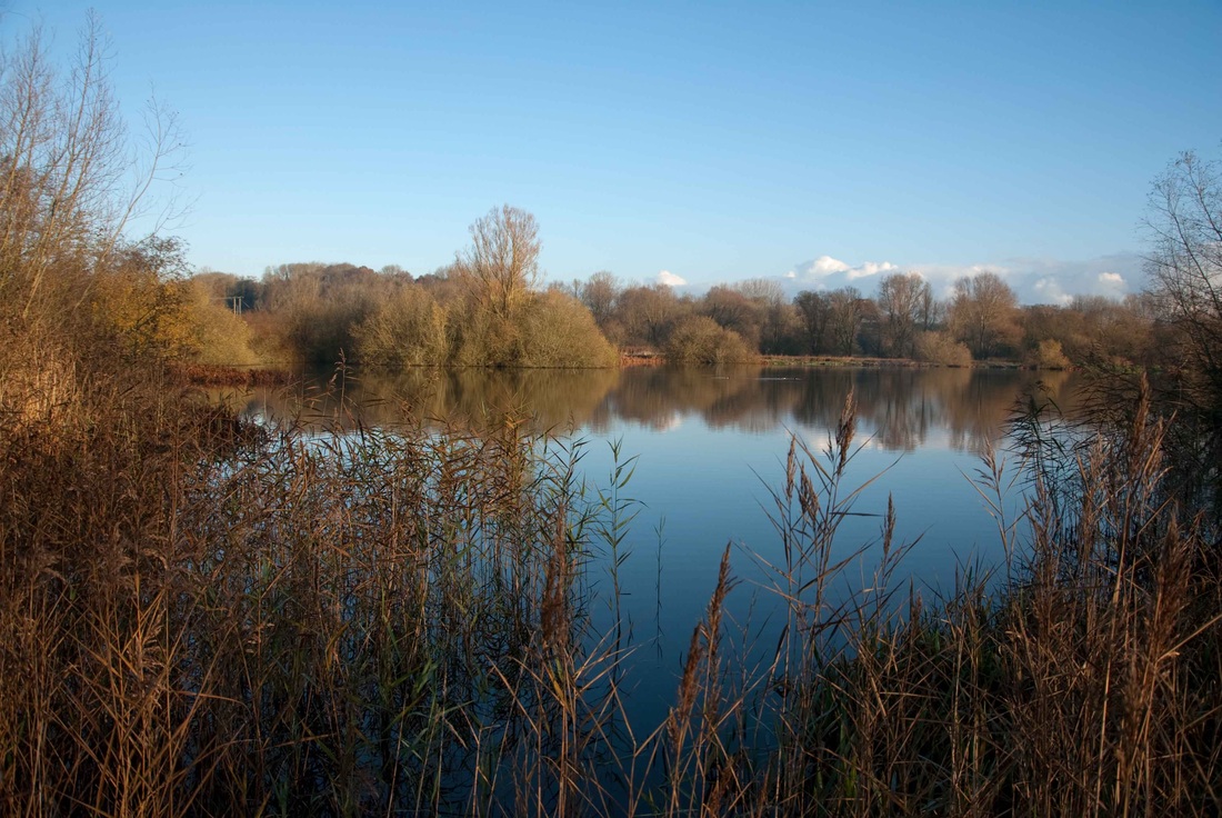
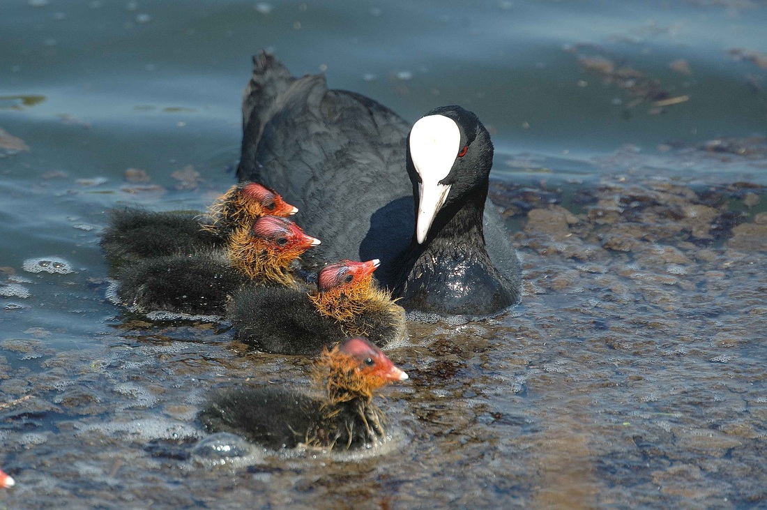
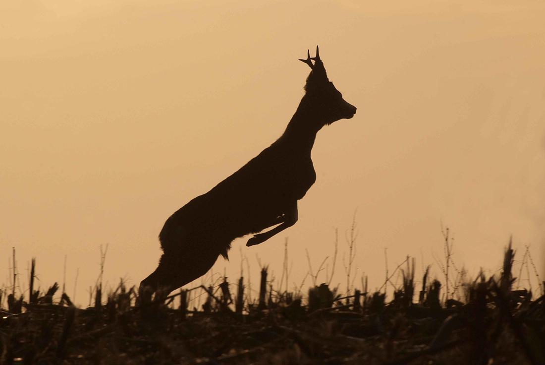
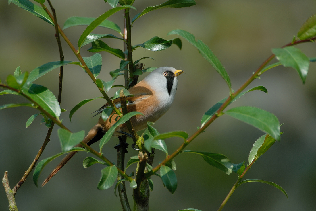
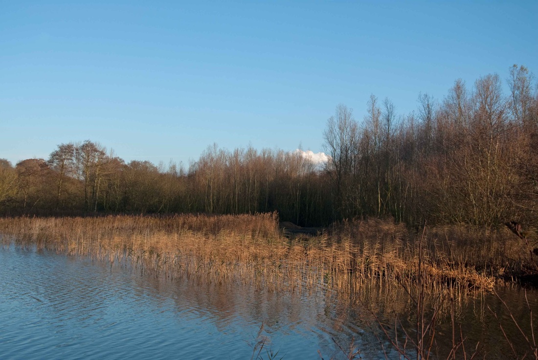
BEFORE - The site prior to development works
The site at Lyng Easthaugh Lakes was worked as a quarry for many years, latterly by Lafarge Aggregates up until 2005. It was then beautifully restored to a wildlife habitat which has become rich in its diversity. Over 160 bird species have been recorded at the site including rare and endangered birds such as barn owl, kingfisher, bittern, turtle dove, and osprey. Scarce plants also flourished including the rare bee orchid. A peaceful haven with the sound of skylarks singing overhead, herons fishing the lakes and the unique River Wesum flowing through the site with its protected SSSI (Site off Special Scientific Interest ) and SAC (Special Area of Conservation) status. This beautiful area was designated a County Wildlife Site by Norfolk County Council and is classed as an "area of landscape quality". The images below speak for themselves.
The site at Lyng Easthaugh Lakes was worked as a quarry for many years, latterly by Lafarge Aggregates up until 2005. It was then beautifully restored to a wildlife habitat which has become rich in its diversity. Over 160 bird species have been recorded at the site including rare and endangered birds such as barn owl, kingfisher, bittern, turtle dove, and osprey. Scarce plants also flourished including the rare bee orchid. A peaceful haven with the sound of skylarks singing overhead, herons fishing the lakes and the unique River Wesum flowing through the site with its protected SSSI (Site off Special Scientific Interest ) and SAC (Special Area of Conservation) status. This beautiful area was designated a County Wildlife Site by Norfolk County Council and is classed as an "area of landscape quality". The images below speak for themselves.

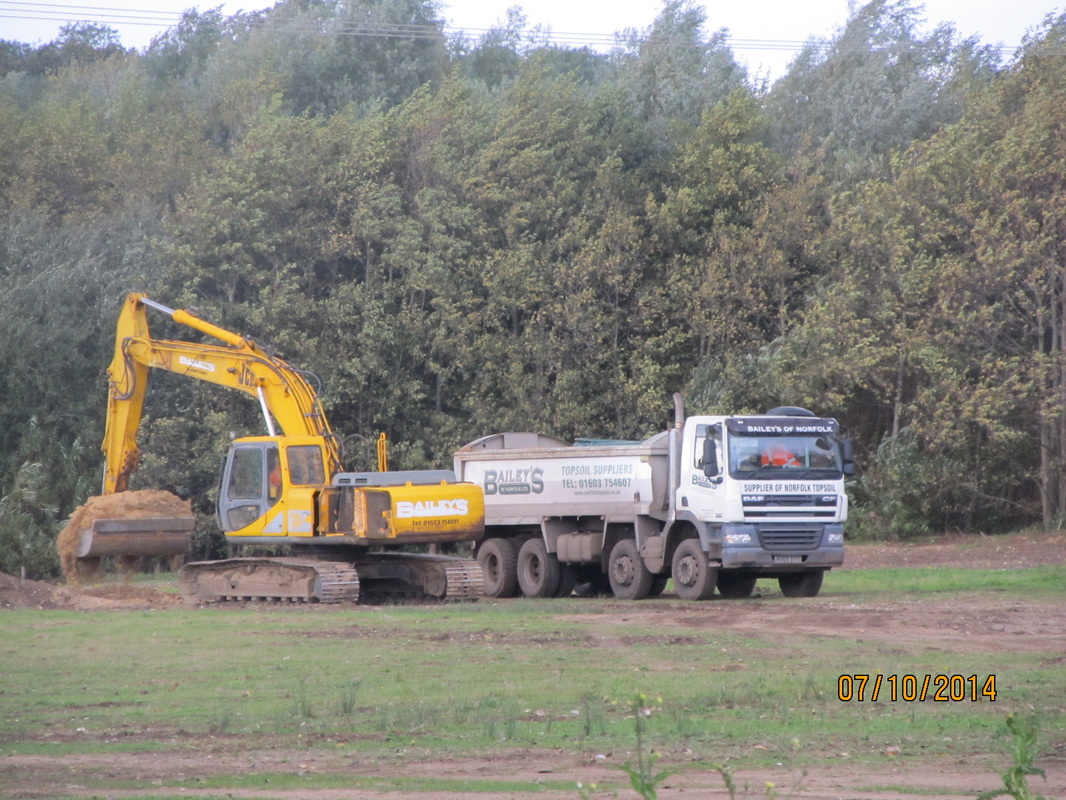
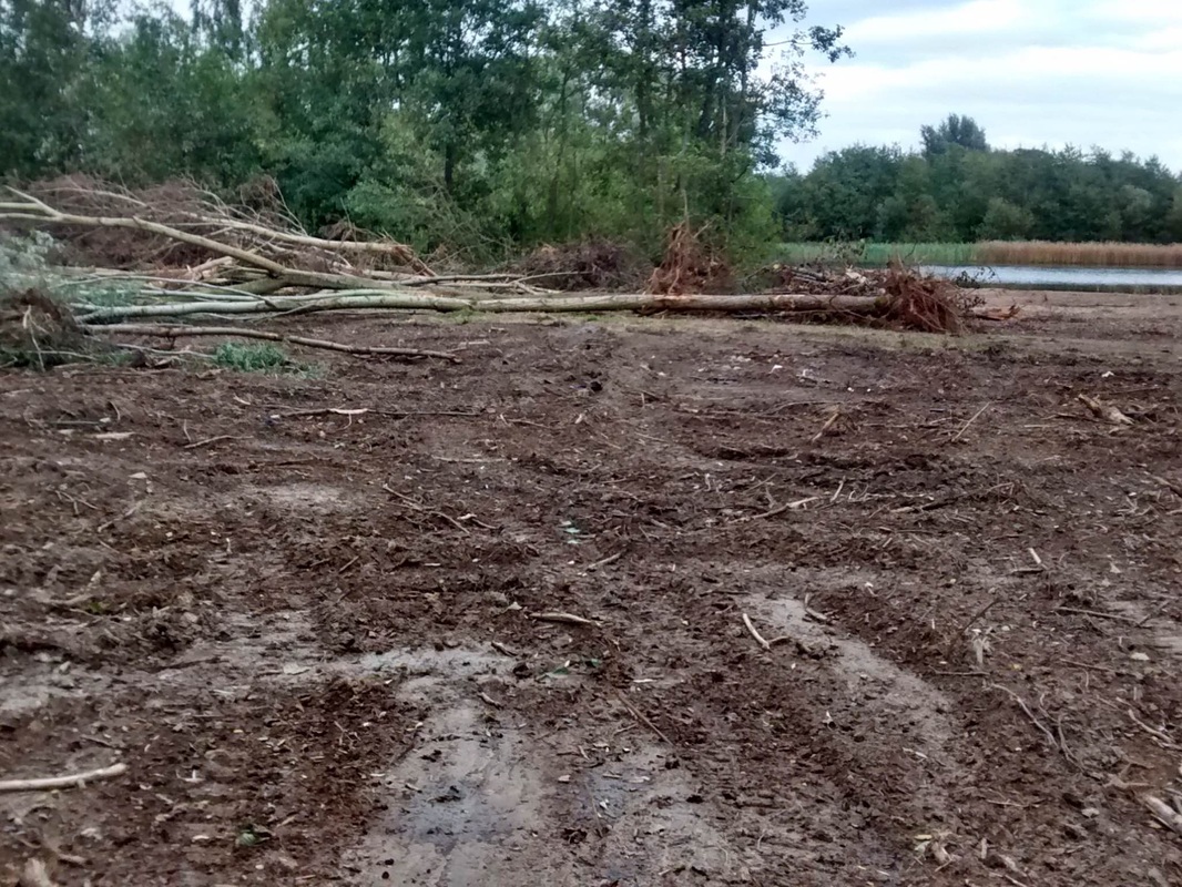
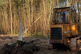
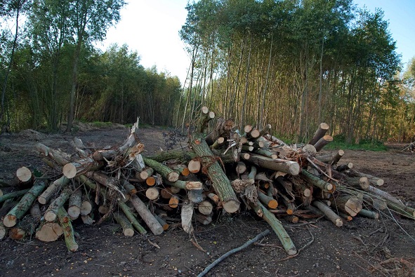
DURING - Development work PRIOR to application for planning permission
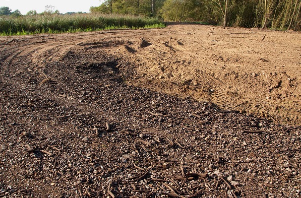
During 2012, without any consent from the planning authorities, the development of a new roadway began across wet boggy marshland on the river Wensum flood plain. Drainage ditches were blocked causing flooding of large areas of marsh and an unprecedented situation whereby flooding remained well into the summer of 2013.
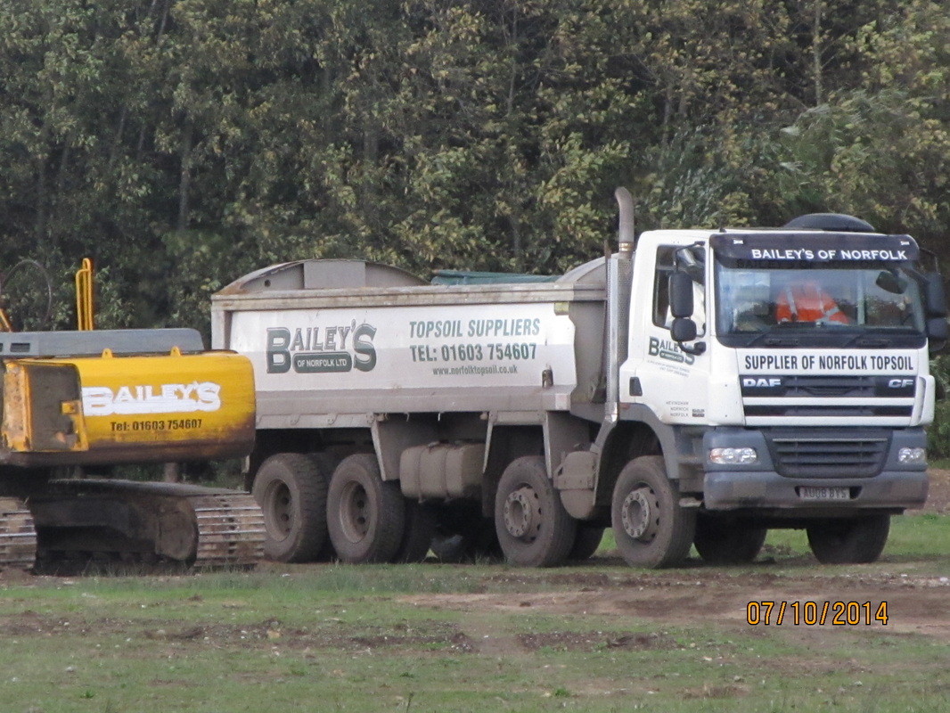
Throughout the summer of 2014 local residents noticed an increasing number of heavy lorry movements delivering soil and waste to the site. The volume of these movements became a cause for concern, as hundreds of tons of this material was being imported. After bulldozing and building up new roadways through woodland, imported waste material was used as hardcore to extend the base for a new raised road across the remainder of the boggy flood plain. It was then covered with a concealing layer of imported aggregate, in an apparent attempt to blend it into the surrounding landscape. The height of this roadway has created a further barrier preventing additional flood water from draining into the river to be carried downstream.
Questions were asked and, at a Lyng Parish Council Meeting in September 2014, development plans for a large scale holiday park were revealed by Mr Nield of Timberpad, project manager for the landowner Bailey. Despite the fact that no planning application had been submitted to Breckland District Council, development was taking place with this construction of the roadway across the flood meadows, clearance of woodland and reed bed and destruction of valuable wildlife habitat.
During 2012, without any consent from the planning authorities, the development of a new roadway began across wet boggy marshland on the river Wensum flood plain. Drainage ditches were blocked causing flooding of large areas of marsh and an unprecedented situation whereby flooding remained well into the summer of 2013.
Throughout the summer of 2014 local residents noticed an increasing number of heavy lorry movements delivering soil and waste to the site. The volume of these movements became a cause for concern, as hundreds of tons of this material was being imported. After bulldozing and building up new roadways through woodland, imported waste material was used as hardcore to extend the base for a new raised road across the remainder of the boggy flood plain. It was then covered with a concealing layer of imported aggregate, in an apparent attempt to blend it into the surrounding landscape. The height of this roadway has created a further barrier preventing additional flood water from draining into the river to be carried downstream.
Questions were asked and, at a Lyng Parish Council Meeting in September 2014, development plans for a large scale holiday park were revealed by Mr Nield of Timberpad, project manager for the landowner Bailey. Despite the fact that no planning application had been submitted to Breckland District Council, development was taking place with this construction of the roadway across the flood meadows, clearance of woodland and reed bed and destruction of valuable wildlife habitat.
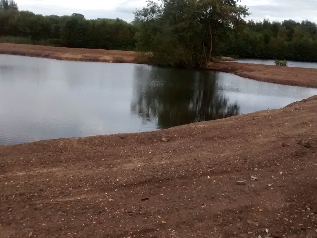
AFTER - Plans for future development of the site
The plans have been submitted to Breckland District Council for the development of a holiday park comprising 45 holiday lodges, reception building and associated infrastructure. There will also be parking spaces for 100 cars. You can view the application and associated documents by visiting the planning search page of Breckland District Council's website here and entering the planning reference: 3PL/2015/0512/F. You will also have the option to enter your objection online.
A development of this scope and scale will have an enormous impact on the tranquil landscape of this part of the Wensum Valley. Local residents will be outnumbered by holiday makers by as much as one thousand percent. The narrow winding Easthaugh Road is not designed for this level of traffic and the lane is habitually used by dog walkers, horse riders, cyclists, slow moving farm vehicles and cows crossing the road for milking. Any increase in traffic will be a disaster in terms of noise, pollution, and the safety of current users as well as visiting drivers. Visibility is poor in many places with limited passing places. Please see our photographs of many traffic hazards in our image gallery. The increased traffic volumes would also impact upon Lyng and other neighbouring villages such as Weston Longville.
Disruption during the construction phase will be detrimental to the rich wildlife on the site and continuing disturbance from human activity, noise and light pollution will drive out resident and breeding species on the site. The River Wensum SSSI will be compromised by the risk of pollution, including from possible flood and seepage of waste from both sewerage and imported aggregates. The development would be constructed on a level 3 flood plain presenting risks to this and other sites along the river, not to mention the danger to humans .
Images and content copyright © Lyng Easthaugh Anti-Development Action Group 2014-2015
